
Raymore Neighbors by Block Source
The most useful sources describe different parts of a Raymore block. Cass assessment and GIS tools connect an address to a parcel. A recorded plat sets out lot, block, subdivision, street, easement, and legal-description information. The city’s neighborhood map supplies a dated community label. Association sites offer public contact or governance routes. None of those sources is a complete list of current household members, and a parcel holder is not automatically an occupant.
| Source | What It Shows About a Block | Access |
|---|---|---|
| Cass GIS and Assessor | Parcel adjacency, assessment context, address, PIN, and deed-holder clues | Public map and real-estate search |
| Recorded subdivision plat | Lot, block, subdivision, street, easement, and legal parcel geography | Recorder, library, or Historical Society depending on date |
| Recorder instruments | Dated title-transfer and legal-description clues for a parcel | Web index from 1980; office and older holdings for earlier work |
| City neighborhood map | Community and subdivision labels on the dated map | City map collection |
| Association contact pages | Public inquiry, governance, meeting, or clubhouse contact route | Association websites |
A public voter-information lookup requires exact registered name, date of birth, last four SSN, and county. It is a confirmation form, not a street-wide search. Missouri’s public voter-list and precinct-register rules have separate request, date, fee, and protected-address limits, so a block question should not be turned into a personal contact list.
Raymore Neighbors on the Parcel Map
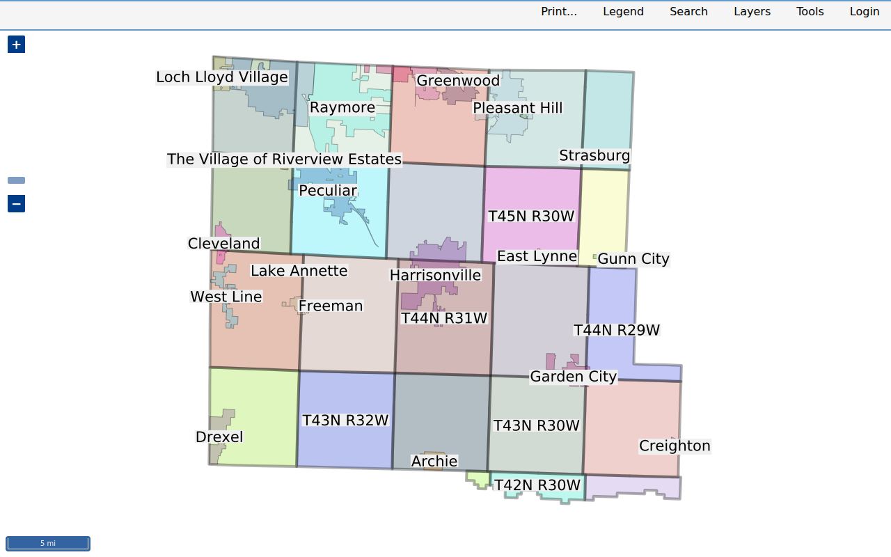
The Cass County GIS landing page links to assessment information and maps, including the Camavision viewer. Use it as a spatial layer. A close view can make parcel lines, streets, a subdivision, and neighboring lots easier to compare with an Assessor result or recorded plat. The research did not expose a stable text inventory for the JavaScript map client, so identify any visible map attribute by the viewer itself and preserve the access date.
The Cass GIS assessment map viewer is the source represented by the image, with a parcel and nearby parcels visible.
Each surrounding parcel needs its own check. A shared driveway, street number, owner, or subdivision name does not merge two parcels, and a current map view does not establish a historical next-door relationship.
The Cass County Assessor search can narrow the starting parcel with house number, street name, city, PIN, deed holder, or legal description. The city selector includes RAYMORE. Assessor data is provided without warranty and should be cross-checked with a recorded instrument when the name or parcel description matters.
Note: A visible parcel boundary confirms map geometry, not a person’s current connection with that Raymore address.
Raymore Block Lines and Labels
“Block” needs a precise meaning in Raymore. It can be a recorded plat block, a census block, a city-map block, or an informal neighborhood unit. A recorded subdivision plat is the legal parcel geography. The city’s current GIS supports present-day infrastructure, zoning, and community-feature context. A ward map is election geography. A ZIP is postal geography. Those layers may overlap, but they should not be treated as interchangeable.
Raymore’s 2007 neighborhood and HOA map identifies Madison Valley, Ward Park Place, Foxwood Springs, Madison Street, Foxwood Drive, Knoll Creek, Alexander Creek, Lincoln Road, Brookside, Eagle Glen, Shadowood, Silver Lake, Stonegate, and The Meadows. It is a dated label index, not a current boundary or membership record. Later replats, association coverage changes, annexation, or ward changes can alter the geography around a Raymore address.
Raymore’s original plat dates to 1874, while Maplewood appeared in 1964 and Bridlecroft and Silver Lake followed in 1966. Those dates explain why a historic plat, a 2007 community map, and a current parcel viewer can describe the same vicinity in different ways.
Map a Raymore Block by Parcel
Use one normalized situs address or PIN as the center point. A situs address is the physical parcel location. It can differ from a deed holder’s mailing address, and neither proves who currently lives there. The adjacent-parcel method keeps the task bounded to the parcels that touch or immediately surround the target, rather than making an unsupported claim about every person on a street.
- Find the target on the Assessor search or GIS map and record the PIN, legal description, subdivision, lot, and block.
- Zoom until parcel lines and labels are legible, then note neighboring PINs only where the viewer exposes them.
- Check each neighboring PIN or address as a separate parcel and compare its legal description with the map and recorded plat.
- Use the Recorder instrument and date when a parcel relationship needs title context, then distinguish the party named in a record from a household occupant.
- For a historical neighbor question, repeat the comparison with the relevant deed date, plat, tax book, or directory year.
A current parcel next door is not necessarily the parcel that was next door at an earlier date. For a whole named street and its broader record chain, use the Raymore Street Directory instead of stretching an immediate-block inquiry beyond its source.
Note: Keep the target parcel and each adjacent parcel separate even when they share a driveway, owner, or similar street label.
Raymore Neighbors and Community Contacts
Association pages can explain who handles a public property inquiry, meeting, bulletin, or community contact. They do not publish a complete roster of Raymore neighbors. Use an association’s own contact route for the stated governance purpose, and do not infer that a household appears in any association record merely because a parcel is near a named neighborhood.
| Community contact | Publicly described route | Boundary |
|---|---|---|
| Brookside HOA | 704 Corrington Dr, Raymore; 816-775-3388; board and contact information | Contact and governance information, not a public member list |
| Ward Park Place HOA | 524 Ripley Drive; board, pool/events, and authorized property-inquiry route | Property inquiry route, not a household list |
| Silver Lake | 113 Silver Lake Circle; 816-322-1883; meetings and clubhouse contact | Serves Silver Lake, Lakeshore Place, and Lakeshore Meadows; no public roster |
| Creekmoor POA | 1112 E 163rd; 816-331-2621 | Public contact route only |
| Madison Creek | PO Box and current board/contact information | Public contact route only |
The city’s Neighborhood House Watch information says several subdivisions have watch programs and provides a setup contact. It does not publish participant names. That distinction matters for a neighbor lookup.
Raymore Neighbors on a Dated Map
A dated community map helps connect a parcel’s subdivision label with local civic context. It cannot establish who lives there or which association currently covers a property. Use the city’s map collection for the neighborhood, subdivision, street, ward, zoning, tax-district, and future-land-use map materials, then compare the map date with the date on a parcel, plat, or recorded deed.
The Brookside association contact page is an example of the public community-contact layer.
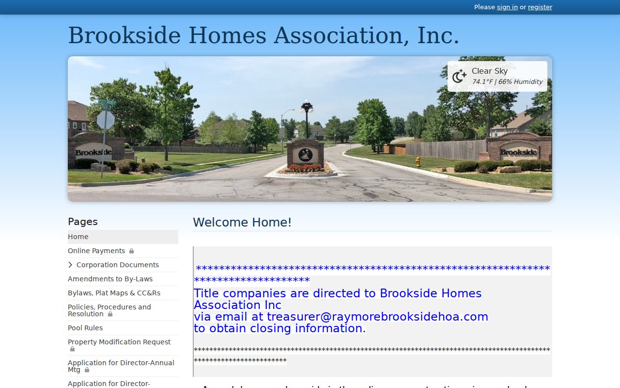
Its public contact and board information may help route a permitted question, but it is not evidence of current household membership or residence.
The 2020 Census led to new Raymore ward boundaries, described in a city notice dated December 17, 2021. Preserve the election-cycle date when using a ward label. A person may remain at the same address while the ward or precinct changes.
Note: Preserve the map date before applying a neighborhood label to a current Raymore parcel.
Raymore Neighbors: Source Comparison
Official records and commercial neighbor tools answer different questions. Official sources can be checked against the custodian, show their stated date or record purpose, and often have defined access limits. Commercial categories may combine records with unclear update timing, may charge for access, and may not distinguish a title holder, old address, or similarly named person. Neither category turns a parcel result into proof of a current household.
| Category | Useful for | Limits |
|---|---|---|
| Official rolls and records | Parcel geography, recorded instruments, title dates, legal descriptions, and dated election context | Record purpose, access rules, and date still limit what can be concluded about neighbors |
| City map and association contact sources | Dated community labels and public governance contacts | Not a membership or household directory |
| Commercial neighbor-tool category | General leads that require independent verification | Cost, accuracy, update timing, and source context vary |
When a public record is incomplete, ask the identified custodian for an existing date-specific record rather than treating an unverified compiled result as a fact. Missouri Sunshine requests seek existing government records, not new analysis.
Limits on a Raymore Neighbor Lookup
An address search cannot disclose every household member, delivery recipient, utility customer, or protected participant. Federal DPPA rules protect DMV personal information. The public voter lookup does not offer a street-wide query. Raymore permit and code-enforcement links can point to property or project records, but the reviewed sources did not establish a complete public address index, retention period, owner-field list, or redaction split.
Missouri Safe at Home gives qualifying residents a substitute address for many government and court records. Missouri voter law also protects specified voter addresses. Do not attempt to identify a protected physical location from a substitute address or combine scattered records to expose private information.
Careful block research names the record, date, parcel, and limit. It does not treat a map, deed holder, association contact, or old community label as a complete account of who lives nearby now.