
Raymore ZIP Code Directory Coverage
The reviewed Missouri ZIP and city material identifies one Raymore postal entry: 64083. It is the verified starting point for a Raymore postal-directory search. The research did not locate a separate official Raymore ZIP, unique ZIP, or city-specific split. That does not mean every location carrying a Raymore mailing label lies inside municipal limits. Postal areas, subdivisions, wards, parcels, and city boundaries are separate systems and should be checked in the system that owns the question.
| ZIP | Areas Covered | Post Office | Notes |
|---|---|---|---|
| 64083 | Raymore city and Raymore postal area | Raymore Post Office or Main Office context in reviewed USPS material | Verified Raymore entry; postal area is not the same as city limits or a subdivision |
The official Missouri ZIP and city dataset maps Cass County, 64083, and Raymore. For a specific mailing address, USPS validation is still the better final check. Do not turn the absence of another ZIP in the reviewed list into a claim that a historical form, rural route, or neighboring postal label is wrong.
Raymore Postal Directory USPS Fields
The official USPS ZIP Lookup has three useful routes. An address search requires street address, city, and state, with optional company, unit, and ZIP fields. A city-and-state search returns ZIP information from those two entries. A ZIP search accepts the code itself. USPS advises adding a unit when several matches appear, and its disclaimer says the result does not prove that a particular person or company is at the address.
| USPS form | Fields or result purpose |
|---|---|
| Address to ZIP | Required street address, city, and state; optional company, apartment or suite, and ZIP |
| City and state to ZIP | City and state inputs for postal ZIP results |
| ZIP to city | ZIP input for cities associated with that postal code |
Use the address route before changing a user-supplied ZIP. A postal answer validates delivery formatting. It does not validate the municipal boundary, a parcel’s ownership, or a person’s connection to the address. Those are separate questions for municipal mapping, county parcel tools, or the appropriate record custodian.
Raymore Postal Change in 2008
Raymore has one documented postal-boundary detail worth preserving in historical research. A USPS Postal Bulletin notice says that 25 deliveries previously using 64082 moved to Raymore, MO 64083 effective July 19, 2008. It was a delivery realignment. It was not an annexation finding, a statement that all nearby parcels changed jurisdiction, or a reason to rewrite the place label in an older record.
Keep the date printed on a deed, newspaper, directory, or form with the postal label it used. When an old source says 64082, compare the street address, lot or subdivision, and original date before adding a modern 64083 cross-reference. The same care applies to Harrisonville or rural-route labels that can appear in older Cass County records.
Note: Postal geography can change independently of city history, so a historical mailing label should be preserved before any modern comparison is made.
Find Raymore Records by ZIP
A ZIP can narrow an address question, but it does not create a citywide resident list. Start by checking the mailing code with USPS. Then use county or city geography to place the address. The Cass Assessor provides a city selector that includes RAYMORE, not a ZIP search. Cass GIS provides parcel and assessment-map viewing, but the reviewed source did not expose a stable ZIP attribute or parcel-to-ZIP crosswalk. The Missouri voter lookup uses county and exact identity fields, rather than a street or ZIP query.
- Validate the street address, city, state, and ZIP with the USPS address form, including the unit when it is needed to distinguish results.
- Use the Cass Assessor’s RAYMORE city selector or a known street and house number to find the relevant assessment record, without calling it a ZIP filter.
- Compare the parcel’s visible geography in Cass GIS with a city map, subdivision, plat, ward, or county boundary when the physical location matters.
- Request a dated election record from the Cass County Election Authority only when the question concerns a statutory voter output and its permitted fields.
Once a ZIP has narrowed the area to a particular street, the Raymore Street Directory has the address-focused workflow for Assessor, GIS, Recorder, and historical land records. A court, professional, business, or historical portal may display a ZIP in a result, but each does so for its own purpose and does not become a ZIP-wide resident search.
Raymore Parcel Geography
The Cass County Assessor real-estate search supports parcel number, DBA, deed holder, house number, street name, city, legal description, acreage, and photo controls. It can help locate the property record after USPS has validated a mailing address. It is not a ZIP search, and its deed-holder field should not be read as proof of occupancy. Assessment values and parcel information can change through the county’s review process.
The Cass Assessor search form shows the city and address fields that are useful after a ZIP has narrowed the location.
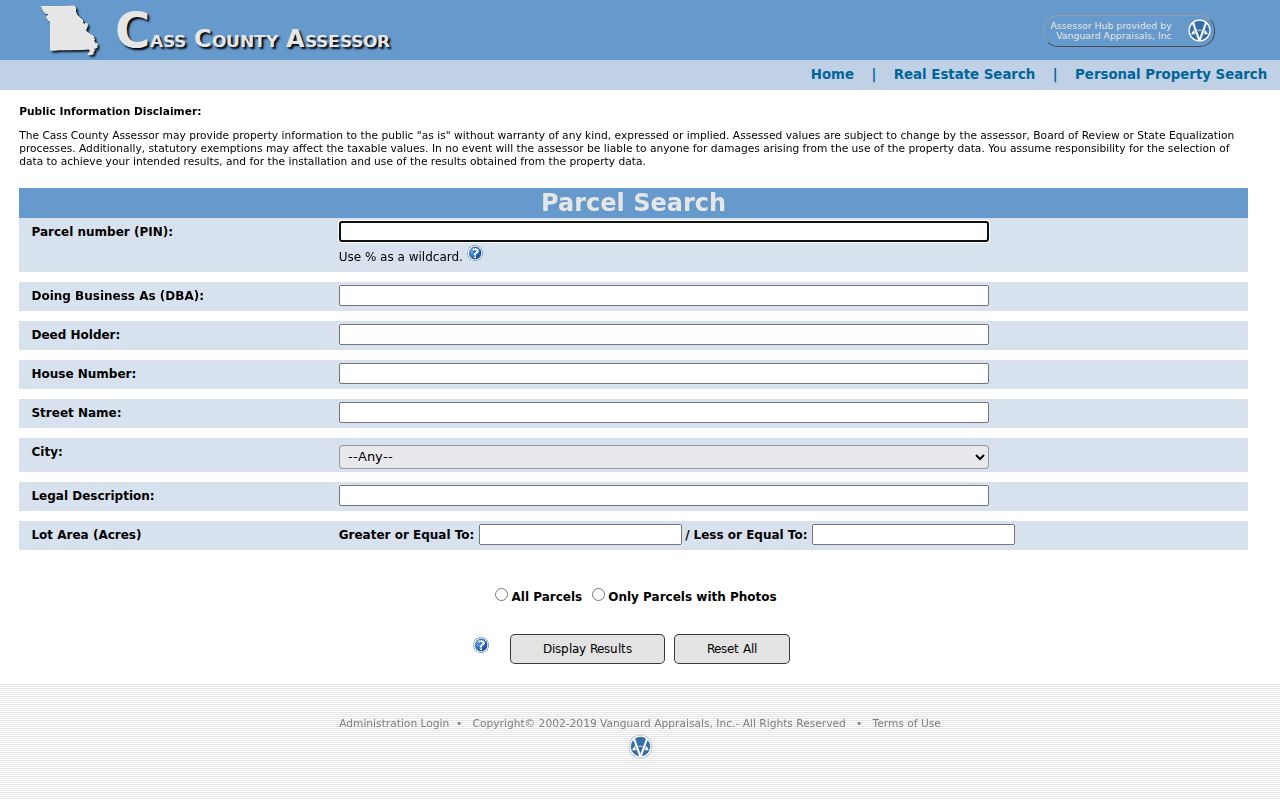
The form’s city selector can focus an assessment search on Raymore, while USPS remains the source for ZIP validation.
Cass GIS assessment maps add the spatial layer. A parcel outline, streets, and subdivision context can help reconcile a mailing ZIP with county geography, but the captured GIS client did not provide a stable text ZIP field inventory.
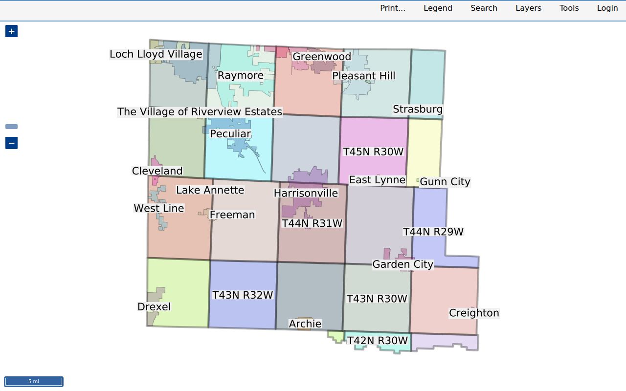
Use the map as a location check, retain the access date, and obtain a recorded instrument from the Recorder when legal land description or title history is needed.
Raymore ZIP Statistical Context
ZIP figures are often mistaken for current city population. The Cass County 2020 Community Health Needs Assessment reproduces 2017 ACS estimates, including 22,423 for ZIP 64083/Raymore, 27,109 for ZIP 64012, and 14,275 for 64701. Those are dated statistical estimates presented in a 2020 report, not a current Raymore count and not a source for identifying people. Cass County’s figure in that comparison is 101,888, with North Cass at 80,529.
The dated figures can explain why a ZIP total differs from a municipal total. They cannot define a postal boundary, prove residence, or show a current household count. For a present-day mailing question, return to USPS. For municipal geography, use city or county mapping. For records, ask the custodian holding the dated record.
Raymore ZIP and City Limits
A Raymore postal directory has to keep postal and civic layers apart. ZIP 64083 is a mailing geography. Raymore city limits govern city services and municipal records. Cass County is the jurisdiction for the Recorder, Assessor, court, election, and health systems. A ward or precinct is election geography that can change after redistricting, while a subdivision or plat describes recorded land context. None of those labels substitutes for the others.
- ZIP and ZIP+4
- A ZIP identifies a postal delivery area. ZIP+4 adds a more specific delivery segment and does not define a municipal boundary.
- PO-box ZIP
- A postal code assigned for post-office-box delivery. No separate Raymore PO-box ZIP was located in the reviewed official sources.
- Unique ZIP
- A ZIP assigned to a single institution or organization. The reviewed official material did not locate one for Raymore.
- Carrier route
- A mail-delivery route used by USPS. It is not a parcel title, ward, subdivision, or resident roster.
ZIP and city limits. A 64083 mailing result should be checked with city or county geography when jurisdiction matters. The postal code alone does not settle that question.
Raymore Postal Directory Place Labels
Raymore’s records live across several geographic layers. A current address may be checked through USPS, a city street map, a county parcel map, a subdivision plat, and a ward map. Older material may use a township, rural route, Harrisonville mailing label, or an earlier postal assignment. Raymore’s addressing policy also requires street names and addresses to be checked during plat work, while county and city maps serve different functions.
This geography is practical for family history and property research. Record the label exactly as printed, then compare the street name, house number, lot or block, subdivision, and date. The 2008 realignment is a reminder that postal delivery areas change on their own schedule. Historical records stay more useful when their original place name is preserved instead of silently converted to a modern mailing label.
The county has no stable public parcel-to-ZIP crosswalk in the reviewed sources. That is why the useful order is USPS for mailing format, Cass GIS or Raymore mapping for physical geography, and the Assessor or Recorder for the record itself. The Assessor can connect a street, city, parcel number, legal description, acreage, and deed-holder field, but its form does not transform those fields into postal proof. GIS can place a parcel alongside streets and subdivisions, but its captured client did not expose a reusable postal attribute list. When a historical source supplies only a rural route or township label, compare the original wording with the plat, legal description, and date before assigning a modern mailing code.
Raymore’s map inventory adds useful context because it includes streets, subdivisions, wards, zoning, tax districts, parks, and future land use. A subdivision name such as Silver Lake, Brookside, or Eagle Glen can help locate a parcel in the correct spatial record, but it is still not a postal boundary. Similarly, a ward can identify election geography while a county office mailing address may use Harrisonville. Preserve every label with its source and date, then let the office that maintains that layer answer the final jurisdiction question.